At land survey drafting service, Land surveying is the procedure, art, and science of managing the physical 3D locations of objects and features of the distances and angles connecting to specific conditions accordingly. A professional land surveyor conducts a land survey. This information and characteristics are habitually upon the surface of the land. Land surveying is for maintaining maps and boundaries, locations, building corners or the area location and features, and further objectives required by management or civil law.

Measuring the building inside out by the use of accurate laser techniques and creating a drawing which portrays the perfect dimensions and layout of the building is termed as an As-built survey. Use an ALTA Survey for an Acquisition.
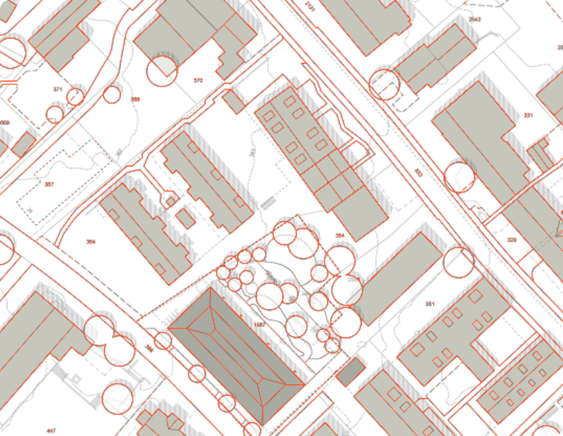
Subdivision Plats are maps drawn with specified scales to reflect the division of land. These indicate lot and block designations on the plat. The boundaries of the easements, alleyways and streets are shown over a plat.
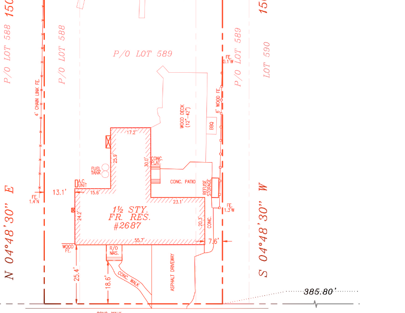
Title surveys are performed by Registered Land Surveyors who are employed by a title insuring agency for the purpose of insuring title to the real estate property. Title surveys are usually needed for real estate transactions.

A Pipeline Survey is the technique of ssessing the present condition of sewer network and water distribution pipelines that run beneath a city estimating the need for repair, replacement or rehabilitation of the pipelines.

Construction surveying is beneficial for assessing the arrangement of the buildings, roads, power lines, gas pipelines and different structures surrounding potential construction sites for analyzing data for the construction.
Site planning survey is a sketch prepared with the data taken from a Survey. A combination of Boundary survey and a Topographic survey and is employed for the preparation of a site plan or other improvements of land.
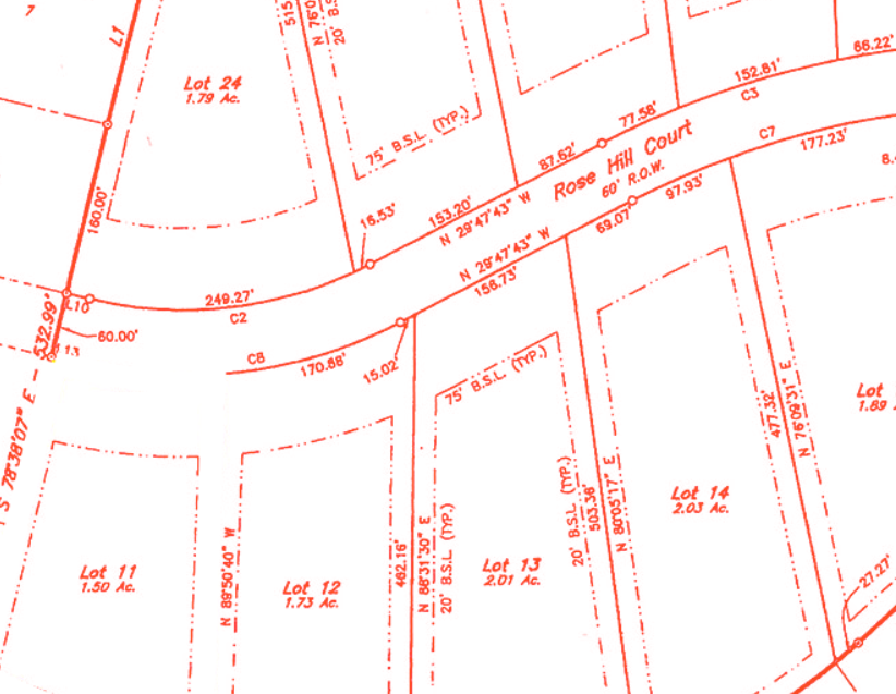
A boundary and location survey is needed to find out the exact plotting done on a terrain. This is used in government surveys as well as private landowners.

The purpose of a topographic survey is to gather information about the elevation of points on a piece of land and show them as contour lines.

Utility survey mainly comes into the picture in the utilities industries where surveys are needed to map the structure, electric poles, water pipeline, etc.

A property needs to be inspected before purchasing. A physical inspection is needed but not enough. The real-estate market always needs a residential mortgage survey to inspect a property.

Tower surveys are surveys conducted on a set of towers in a specified area. From finding tower load to finding extra tower requirements, there are a number of the reason these surveys are conducted.
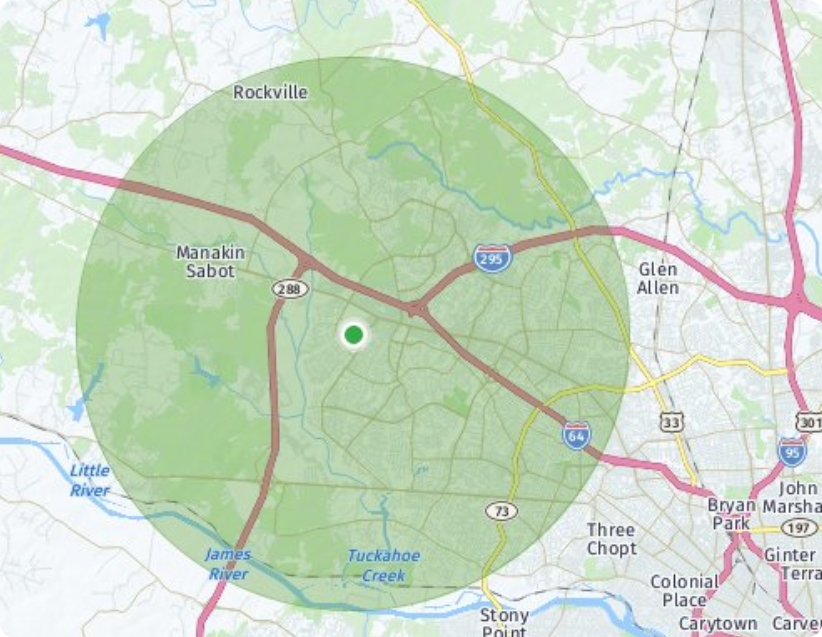
The radius map, which measures the length between the center of a circle and a point on its perimeter based on distance. Search by address or start using the map controls to navigate to your chosen location.
Why bimplify?

Competitive prices, high quality, and quick turnaround time.

Full-service solutions for your customized requirements.

Dedicated Project Manager for each project.

Increased productivity by converting a conceptual design to a detailed CAD drawing.

Perfect Ideation, Converting your imagination in to a creative successful design..

Advanced use of computer tools which removes the problem of duplication of labor.
Do what you do the BEST, Outsource to us the rest!
Contact Us
Text us by scanning the QR code